
After leaving SMA we headed for Guanajuato. We were there a year ago and knew that it would take more than one visit to see more of the city. Some of the history and information that we found interesting on our previous visit can be found by linking to last year's post. I wrote about some of the history of this area and the role of the hero Pipila whose massive statue overlooks the city as seen in the photo above.
Guanajuato is built around a narrow valley. Colorful houses are perched on steep hillsides and streets wind up and around the city.

The streets of Guanajuato follow the rugged mountainsides with small alleyways, plazas and in some cases steep staircases up hillsides. Our friends Ericka, Antonio, and Andoni joined us for the weekend and showed us some of their favorite places. Here they are posed with Brian at the bottom of one of these staircases next to an Irish Pub(?).

Because of its topography there isn't one main plaza as there are in many Mexican towns. Instead, the alleyways and staircases link a series of plazas, mansions, and historic buildings. This gives Guanajuato a bit of a European flavor.

The streets in the central historic district are narrow and winding but very picturesque with decorative balconies and colorful flowers. This is a town that is better seen on foot than in a car, although we did see some smaller buses navigating the streets.

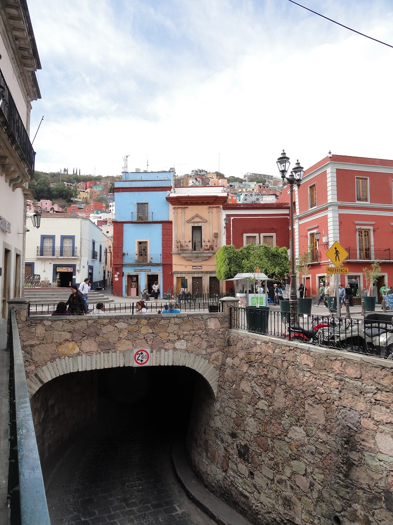
The tunnels in Guanajuato are a distinguishing feature that make driving a nightmare. The city was prone to flooding so a series of long channels were dug to divert the water. Today these tunnels have been converted into roadways. They are extensive and complex. Maps of the city show roads and routes but it's very confusing because the roads are on two levels and it's not easy to figure out which are underground. In addition, the tunnels are adequate for cars and small buses, but definitely not most RVs. It's always a horror story when we hear of a fellow RVer who somehow ended up in the tunnels.
The following map of Guanajuato shows streets which have solid lines for the border, tunnels which have dotted lines for the border, and the alleyways are dotted lines. Difficult to see, but clicking on the map will enlarge it and give an idea of what I'm trying to convey. Crazy and what a maze to navigate.

Entrances to the tunnels are found throughout the city.
Although it's no fun for driving, we really love walking around and seeing the sights. One of the places we went last year was the Teatro Juarez but we were unable to get inside at that time. This year we toured the magnificent interior.


I took a picture of this alleyway leading to a beautiful brick building with pink flowerboxes because I thought it was a pretty cool scene.

A few minutes later while I was doing a little silver jewelry shopping -this is the silver city- Brian told me to come out and see what was coming down the walkway. Love it.

A few other street scenes....


Andoni, Ericka, Sue and Brian in one of the plazas.

We had a great time in Guanajuato, and as I said in my last post there's so much to see and do that we'll have to return again and again. After leaving Guanajuato we headed back to Arizona, where we'll be for a few months taking care of business until it gets too hot and we're ready to hit the road again.
Maps of our journey follow
 |
| San Miguel de Allende to Guanajuato, approximately 50 miles |
 |
| Guanajuato to the Columbia Crossing in Texas |